
In the United States, the FAA regulates aviation safety and airspace use. State and local governments can still regulate matters such as land access, privacy and certain uses of drones, subject to federal preemption. For a pilot, the practical consequence is that FAA authority to fly does not settle every permission needed for the job. The FAA's airspace guidance explains that division.
When comparing federal vs local drone laws, separate three questions: Can this flight operate under federal rules? Can the crew use this location? Is the planned activity lawful here? A certificate, an airspace authorization and a property owner's consent answer different questions.
On This Page
- Which authority controls which decision?
- Establish the federal rules for this flight
- When does federal law preempt a local drone rule?
- Read the launch-site rule separately
- Use the right FAA application process
- Keep documents that answer separate questions
- Resolve the actual restriction before dispatch
Which authority controls which decision?
Use this comparison to direct a question to the right authority before arranging a flight.
| Decision | Federal role | State, local or property role |
|---|---|---|
| Pilot qualification and flight limitations | FAA operating and certification rules | A local permit cannot replace FAA qualification or waive a federal flight limit |
| Access to controlled airspace | FAA authorization where required | A client's approval cannot grant airspace access |
| Launch, landing and crew position | Airspace approval does not grant land access | Check the owner or managing agency's applicable access rules |
| Privacy, harassment and use of imagery | Federal flight compliance does not settle every conduct issue | Applicable state and local laws may govern the activity |
| A posted drone restriction | Determine whether an actual federal airspace restriction applies | Read the underlying local rule to identify its scope and exceptions |
Source basis: 14 CFR Part 107, the FAA Airspace Access guidance and FAA No Drone Zone guidance. The questions and comparison are practical applications of those authorities, checked September 8, 2026.
Establish the federal rules for this flight
For an ordinary civil drone operation under 55 pounds, including everything attached at takeoff, Part 107 is the usual non-recreational route. Its baseline includes a qualified remote pilot in command, visual line of sight and a normal ceiling of 400 feet above ground. The structure exception permits flight within a 400-foot radius of a structure and up to 400 feet above its immediate uppermost limit. It does not remove other restrictions. See Part 107, particularly §§107.3, 107.12, 107.31 and 107.51.
A flight does not become recreational simply because nobody pays for it. The FAA recreational-flyer guidance identifies the flight's purpose as decisive. Taking photographs for an organization's website or volunteering an inspection can be non-recreational. The limited recreational exception under 49 U.S.C. §44809 has its own conditions, including TRUST testing and proof, recognized community safety guidelines, visual line of sight and prior authorization in the specified controlled airspace. A Part 107 pilot may also choose to conduct a genuinely recreational flight under that exception when all its conditions are met.
Registration is another separate requirement. The FAA registration guidance requires registration for Part 107 aircraft, including small models that could qualify for the lightweight recreational exception. Being small does not create a general exemption from drone rules.
Registered drones and drones required to be registered must comply with Remote ID. The FAA Remote ID guidance describes standard equipment, broadcast modules and qualifying operations inside an FAA-Recognized Identification Area. A local flying field is not automatically such an area, and Remote ID compliance does not grant flight permission.
Night operations and flights over people or moving vehicles may be possible without an operational waiver when all applicable conditions are satisfied. They are not blanket privileges of holding a certificate. The FAA commercial-operator overview explains those conditional permissions. Heavier aircraft and specialized operations require a separate determination of the federal operating basis.
When does federal law preempt a local drone rule?
Preemption means federal law displaces a conflicting or otherwise preempted state or local requirement. The FAA and DOT's July 2023 fact sheet distinguishes two particularly useful tests:
- Field preemption: states cannot create their own aviation-safety or airspace-efficiency regime, such as local pilot licensing or flight-routing rules for those purposes.
- Conflict preemption: even a rule pursuing another objective may be displaced if it conflicts with federal requirements or obstructs federal objectives.
The document says a citywide overflight ban justified by privacy would very likely be preempted. It also says a narrowly tailored privacy or security restriction at lower altitudes could be more likely permissible. Purpose, scope and practical effect matter. There is no universal altitude below which every local restriction is valid, or above which property interests disappear.
The fact sheet is agency legal guidance, not a judgment invalidating every similarly worded ordinance. If a job depends on disregarding a disputed rule, get its exact text reviewed before flying. The fact sheet provides the FAA Aviation Litigation Division's contact for preemption questions.
Read the launch-site rule separately
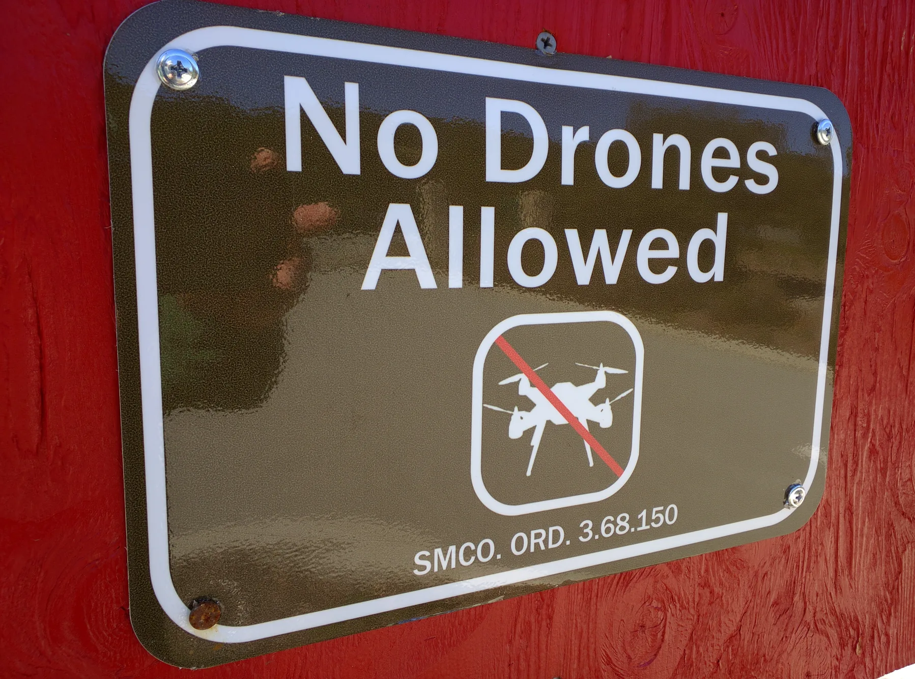
The FAA's No Drone Zone guidance explicitly distinguishes local takeoff-and-landing restrictions from restrictions on flight through the airspace overhead. An airspace authorization does not authorize launch from land where the applicable local rule prohibits it.
Consider a hypothetical photography job beside a county park. The pilot has the required FAA airspace authorization, but the intended launch point is inside an area closed to drone launches. The authorization leaves that access problem unresolved. Ask the managing agency whether a permitted location or applicable exception exists before committing the crew. Moving to a different site also calls for reviewing the route, observation position and relevant permissions again.
Federal land managers can impose their own site rules, too. The National Park Service says its 2014 policy restricting launch, landing and operation on NPS-administered lands and waters remains in force with limited exceptions. It directs visitors to the individual park and superintendent for allowed areas or permits. That policy does not replace FAA requirements, and it should not be generalized to every agency's public land.
An old photograph of a sign is useful context, but use the current managing agency's rule for an actual flight decision.
Use the right FAA application process
An airspace authorization addresses access to specified controlled airspace. An operational waiver permits a defined deviation from a waivable Part 107 rule. Neither is a local land-use permit.
For Part 107 flight in Class B, C or D airspace, or the surface area of Class E designated for an airport, follow the FAA airspace-authorization process:
- Identify the location, altitude, date and time of the proposed operation.
- Use an FAA-approved LAANC service where supported. LAANC is the Low Altitude Authorization and Notification Capability.
- Where manual processing is needed, use FAADroneZone. Requests above a facility-map value may require further coordination; a map value alone is not an authorization.
- Read the issued approval and keep the operation within its actual conditions. A submitted request is not permission to fly.
For a deviation from a waivable operating rule, the FAA Part 107 Waivers page now directs new applications to the Aviation Safety Hub. Previously submitted waiver applications remain in FAADroneZone for processing, and the FAA says airspace-authorization applications remain there until further notice. Older instructions telling pilots to submit every new waiver through DroneZone can therefore misdirect them.
A waiver application must identify the relevant rule, describe the operation, explain hazards and propose mitigations. Answer the applicable FAA safety-explanation guidance and wait for the issued decision before deviating. Only listed rules are waivable, and the approval's scope controls what it permits.
Keep documents that answer separate questions
Under §107.7, a person exercising remote-pilot-certificate privileges must possess the certificate and identification and have them readily accessible. The rule includes presentation to federal, state or local law enforcement on request. FAA preemption does not mean a pilot can refuse every local officer's request for those documents.
The FAA registration page also requires the registration certificate in the operator's possession during flight; paper or digital copies are accepted. Recreational flyers must carry their TRUST proof when operating under the recreational exception.
For a professional assignment, assemble a small job folder containing:
- the applicable pilot and aircraft documents;
- any issued FAA authorization or waiver, including its conditions;
- any required site permit and the owner's or manager's permission;
- the exact state or local provisions relevant to launch, crew position and the planned activity; and
- a dated note recording unresolved restrictions, agency contacts and the final location decision.
The folder is a recommended operating practice, not a universal FAA form. Permit conditions determine any additional local documentation. Keeping each approval separately makes it easier to spot a gap instead of treating one document as permission for the entire job.
Resolve the actual restriction before dispatch
Before accepting a location, write down who controls the airspace, who controls the launch site and which conduct rules affect the assignment. Review the relevant state statutes as well as the municipal code and land-manager rules. If an answer is unclear, obtain the current provision and ask the responsible office about its application to your planned activity. A generic question about whether drones are allowed often leaves the crucial distinction unanswered.
Recheck the FAA's airspace restrictions for the flight's location and date. Temporary restrictions, local closures and application procedures can change after a job is booked. A clear airspace map cannot, by itself, establish permission to enter a property or conduct the planned photography.
The workable plan is one in which the federal operating basis, site access and activity permissions all cover what the crew actually intends to do.
Sources
- FAA Aeronautical Information Manual, Airspace Access for UAS: official operating guidance on airspace access and the federal/local division of authority.
- 14 CFR Part 107: federal regulations covering small-aircraft operations, pilot qualifications, inspection and waivers.
- FAA No Drone Zone guidance: official explanation of local ground restrictions and airspace permission.
- FAA Recreational Flyers and Community-Based Organizations: applicability and conditions of the limited recreational exception.
- FAA How to Register Your Drone: registration applicability and certificate carriage.
- FAA Remote Identification of Drones: Remote ID applicability and compliance options.
- FAA Certificated Remote Pilots including Commercial Operators: conditional night and over-people operating permissions.
- FAA/DOT State and Local Regulation of UAS Fact Sheet, July 14, 2023: agency legal interpretation of preemption, examples and the consultation contact.
- NPS Uncrewed Aircraft in the National Parks: federal land-management policy and park-specific exception inquiries.
- FAA Part 107 Airspace Authorizations: LAANC, manual requests and further coordination.
- FAA Part 107 Waivers: current application portal and safety-explanation requirements.
- FAA Airspace Restrictions: official starting points for location-specific restrictions.
Last checked: September 8, 2026. U.S. federal guidance is current to this check; verify the particular state, local and land-manager rules for the operation.