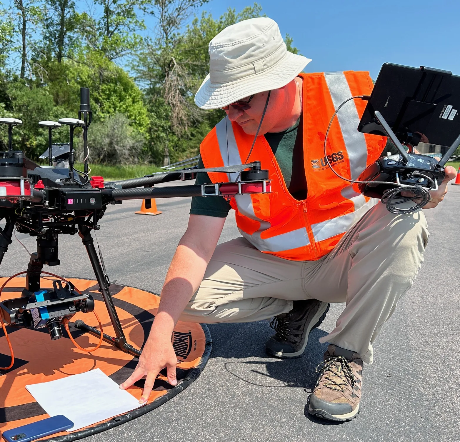
To conduct a drone site survey, define the proposed flight area, check airspace and ground access, inspect the location, and turn each hazard into a flight limit or a reason to hold. Finish with a marked site plan, a crew briefing, and a documented go/no-go decision. Recheck changing conditions immediately before launch.
Here, a site survey means the preflight assessment of an operating location, rather than the aerial mapping mission itself. This process is for U.S. small-drone operations under Part 107. It connects the desk review, physical walk-through, and aircraft preflight so a safe-looking launch spot does not conceal a problem elsewhere on the route.
On This Page
- Set the mission and gather prerequisites
- Check airspace and ground access separately
- Walk the site and mark the whole operating area
- Convert conditions into flight limits
- Use the drone site survey checklist
- Brief the crew, record the decision, and recheck
Set the mission and gather prerequisites
Write down the task, exact location, proposed flight date and time, aircraft and payload, required coverage, and intended maximum altitude. Include the transit between the launch point and the work area, the turns at the edge of the mission, and the return. A site survey must cover wherever the aircraft could be intentionally flown, including its planned recovery route.
Designate the remote pilot in command (RPIC) who will make the flight decision. Bring the aircraft operating instructions and the organization's operating procedures. Confirm pilot qualification and current aeronautical knowledge before assigning that role; the FAA's remote pilot certification guidance explains the recurrent-training requirement of every 24 calendar months. The pilot must also have the remote pilot certificate and identification physically in possession and readily accessible when exercising those privileges, under § 107.7.
Have the registration certificate available, check the aircraft's registration marking, and confirm the operation's Remote ID compliance path. The FAA requires registration certificates to be in the operator's possession during flight, in paper or digital form. Its registration instructions and Remote ID guidance address those separate checks. A site checklist does not establish aircraft eligibility by itself.
Gather a current aeronautical chart, a site map or recent overhead image, weather information, applicable authorizations or waivers, and the site contact's access instructions. If the job is mapping, define the deliverable and ground-work needs before planning the flight: where must personnel place or inspect targets, and can they reach those locations safely? Do not treat a completed safety assessment as proof of mapping accuracy.
The legal starting point is 14 CFR § 107.49. It requires an assessment of weather, local airspace and restrictions, people and property, and other ground hazards, along with crew information, working control links, adequate power, and secure payloads. The written form below is a recommended way to organize that work. Section 107.49 does not prescribe this form or a universal survey-record retention period; an authorization, waiver, employer, or contract may impose additional records requirements.
Check airspace and ground access separately
Plot the whole operating area against current airspace information. Identify nearby airports, heliports, and other aircraft activity as well as the airspace class at the intended heights. Under § 107.41, prior air traffic control authorization is required in Class B, C, or D airspace and within the lateral boundaries of Class E surface airspace designated for an airport. Class G does not remove other operating restrictions or the obligation to avoid interfering with airport traffic.
For controlled airspace, use the FAA's LAANC guidance to find the appropriate authorization route. LAANC means Low Altitude Authorization and Notification Capability. Where it is unavailable, the FAA identifies a manual authorization process through FAADroneZone. Read the issued authorization for the actual area, dates, times, altitude, and operating conditions; a submitted request is not an approval.
Two common mistakes deserve an explicit check:
- A facility-map altitude is not permission to fly. The FAA's UAS Facility Maps explanation says the grid values inform authorization requests. They do not authorize operations at those heights.
- Airspace authorization is not land-use approval. Confirm permission to access and use the launch and recovery sites and check the applicable land manager's rules. The FAA's No Drone Zone guidance expressly separates airspace authorization from permission to take off or land on property.
Review current flight notices and temporary flight restrictions for the operating window, including their boundaries and effective times. Keep the source and time of the check with the job record. LAANC authorization covers airspace access only; the FAA still requires pilots to check notices, weather, and restrictions. An old screenshot cannot establish that conditions remain unchanged at launch.
If the intended route needs a departure from an operating rule, identify that before scheduling the job. An airspace authorization does not automatically permit flight beyond visual line of sight or an otherwise noncompliant operation over people. The FAA's Part 107 waiver guidance distinguishes operational waivers from airspace authorization. Redesign or hold the mission until the required authority is in place.
Walk the site and mark the whole operating area
Compare the desk plan with the location as it exists now. Walk only where access is permitted and safe. Ask the site contact about scheduled deliveries, machinery movements, public access, temporary structures, and work that may change during the flight. Mark anything that could invalidate the planned route or recovery.
Use a site sketch with a north arrow, recognizable landmarks, and labeled photographs where helpful. Record these features:
- Obstacles: trees, rooflines, cranes and their possible movement, poles, overhead cables, and guy wires. Note whether an obstacle height is measured, documented, or merely estimated. If clearance depends on an uncertain height, resolve it or change the route.
- People and vehicles: entrances, paths, parking areas, roads, outdoor work locations, and places where people may gather. Check the route at its edges as carefully as the launch area.
- Launch and recovery: a stable working surface, room for the aircraft and crew, access control, and a usable alternate landing location. Include the path to each location and how it could become obstructed.
- Crew positions: places from which the aircraft and surrounding airspace can be observed, with effective communication if a visual observer is used. Mark buildings, vegetation, terrain, or glare that could obstruct the view.
- Ground and environmental hazards: loose material, water, slopes, unstable footing, wildlife activity, and site machinery. Include hazards to the crew walking to a position or retrieving equipment.
These are practical applications of the FAA's AC 107-2A, Appendix E, which addresses the operating environment, control-station and landing-site suitability, people entering the flight area, and aircraft readiness. The advisory circular is guidance; the underlying regulations and any issued operating conditions control.
Visual line of sight is more than a camera feed or a dot on a map. Sections 107.31 and 107.33 address seeing the aircraft, determining its orientation and movement, observing surrounding hazards, and coordinating with an observer. Plan crew positions and flight segments to meet those requirements. Do not assume that placing an observer behind a building authorizes the pilot to conduct a route that otherwise fails § 107.31.
For example, suppose a roof inspection would take the aircraft behind the far roof edge. If the planned crew positions cannot support compliant visual observation, break the job into separately assessed flights from suitable positions or change the inspection method. A clear takeoff area does not solve an obstructed flight segment.
Convert conditions into flight limits
A useful survey changes the flight plan. For each hazard, record what the crew will do, who will do it, and what condition stops the flight. “Watch for pedestrians” leaves those decisions unresolved. “Keep the route inside the inspected boundary; hold launch if anyone enters the recovery area” gives the crew an action.
Weather and altitude
Compare local observations with aviation weather information representative of the site and the expected conditions through recovery. Record wind and gusts with units, visibility, clouds, precipitation, and temperature as relevant to the aircraft. Appendix E calls for considering wind and density altitude, the effect of atmospheric conditions on air density, when reviewing performance. Select operating limits within the aircraft instructions and crew capability, with a usable margin for return and landing; a published maximum is not a target.
For ordinary operations without a relevant waiver, § 107.51 requires at least 3 statute miles of flight visibility from the control station, at least 500 feet below clouds, and 2,000 feet horizontally from clouds. Its normal altitude ceiling is 400 feet above ground level, with a specified exception for flight within a 400-foot radius of a structure and no higher than 400 feet above its immediate uppermost limit. Any lower applicable authorization limit still controls. Meet the visibility and cloud limits as well as visual line of sight; these are separate checks.
Translate the chosen height into the reference used by the aircraft's display. If a display reports height above takeoff, a hypothetical flight 200 feet above a ridge launch point is 450 feet above terrain that falls away 250 feet below the launch point. That is an illustrative calculation, not a flight recommendation: 200 + 250 = 450 feet. Verify the actual terrain and altitude reference instead of treating takeoff-relative height as height above the ground everywhere.
For a night mission, assess the site in the expected lighting, including crew footing, obstacle visibility, and recovery areas. Under § 107.29, ordinary night operations require the applicable updated pilot knowledge test or training and anti-collision lighting visible for at least 3 statute miles with a flash rate sufficient to avoid a collision. A daylight walk-through alone does not show whether the nighttime observation and recovery plan will work.
People, return routes, and system readiness
Use a route that avoids flight over uninvolved people and moving vehicles unless the aircraft and operation meet the applicable requirements. A site induction or a worker's awareness of the drone does not by itself make that person a direct participant in its operation. Sections 107.39 and 107.145 address operations over people and moving vehicles; a closed worksite is not a blanket exemption.
Before launch, confirm the aircraft-specific response to lost control link, low energy, and a requested return or landing. Check the return destination and path against the marked obstacles, people, terrain, and altitude limits. Do not apply one return-height setting across every aircraft or site. If the available recovery behavior cannot fit the location, move the launch point, revise the operating area, or hold the flight.
Complete the manufacturer's preflight inspection at the selected position, including control and navigation indications, battery condition and available power, propellers, attachments, and payload security. Appendix E supports these checks and calls for compass calibration if required, rather than automatic calibration at every new site. Resolve warnings using the operating instructions; lifting off to see whether a warning disappears is not a substitute for establishing readiness.
Use the drone site survey checklist
Copy this table into the job record and complete the evidence column with actual findings. It combines § 107.49, the other Part 107 provisions discussed above, and AC 107-2A Appendix E. The record fields and hold actions are editorial recommendations for applying that material, checked September 8, 2026.
| Check | Evidence to enter | Hold or revise when |
|---|---|---|
| Mission and boundary | Task, location, flight window, aircraft, payload, full route, maximum altitude and reference | The route or required coverage is still undefined |
| Pilot and aircraft eligibility | RPIC, qualification/current-training check, registration, Remote ID path, required documents | The assigned pilot or aircraft is not ready for this operation |
| Airspace and notices | Chart/reference, airspace class, authorization details if required, current restrictions and check time | Permission is missing or a restriction conflicts with the mission |
| Ground access | Launch/recovery access permission, land-use conditions, site contact | The crew cannot lawfully use the intended ground locations |
| Obstacles and terrain | Marked map, obstacle heights and confidence, terrain changes, excluded areas | Clearance or the altitude reference is unresolved |
| People and traffic | Entry routes, expected movements, flight boundaries, person responsible for each agreed control | People or vehicles would enter an area incompatible with the planned operation |
| Weather and light | Observations and forecast, units, operating limits, expected changes | Legal minima, aircraft limits, or crew limits cannot be met through recovery |
| Observation and communication | Pilot/observer positions, obstructed sectors, agreed calls and communication check | Required visual observation or effective coordination cannot be maintained |
| Normal and alternate recovery | Landing locations, return/lost-link behavior, route and energy reserve plan | The aircraft has no workable recovery within the site's limits |
| Aircraft preflight | Inspection result, control-link check, power, payload security, unresolved warnings | A defect or warning prevents establishing a safe condition for flight |
| Decision and recheck | Go/no-go, RPIC and time, remaining restrictions, events that require reassessment | A safety-critical unknown remains or a recorded control is not in place |
Treat an unknown as an unresolved item, not a checked box. A control that depends on someone closing a gate or pausing machinery is effective only once that action is confirmed. Do not use an aggregate risk score to cancel out a missing authorization or an aircraft defect.
Brief the crew, record the decision, and recheck
At the site briefing, use the marked map to identify the flight limits, crew positions, landing areas, and likely traffic. Explain normal duties, the words used to call a hazard or stop, and the responses to a person entering the area, approaching aircraft, lost communication, or an unavailable landing site. Record the emergency access point, site contact, and how the crew will summon help. Verify that everyone directly participating understands the operating conditions, hazards, contingency procedures, and emergency procedures required by § 107.49.
Before committing to flight, the RPIC should be able to answer three questions: Can the mission stay within its legal and physical limits? Are the planned controls actually in place? Can the aircraft be recovered if the normal plan stops working? Section 107.19 places final operational authority and responsibility with the RPIC. Schedule pressure from the customer does not change that responsibility.
Keep the dated site sketch, observations, source-check times, permissions and issued conditions, crew briefing record, and decision together. Record changes made on arrival rather than silently replacing the desk plan. Use the retention requirements that apply to the operation and your organization's record policy; do not label an invented retention period as an FAA rule.
A repeat visit can reuse the site's background information, but it still needs a current assessment. Recheck before launch and between flights when weather, personnel, aircraft configuration, airspace notices, access, or site activity changes. If conditions change in flight, respond under the briefed procedure and the actual circumstances, yielding to other aircraft and landing safely when needed. Reassess before resuming.
The finished survey should let another crewmember point to the map and explain where the flight can occur, what could stop it, and where recovery will take place. If any of those answers remains uncertain, resolve it on the ground before launch.
Sources
- 14 CFR Part 107, Small Unmanned Aircraft Systems: regulatory text for pilot responsibility, preflight assessment, visual observation, airspace, people and vehicles, and operating limits. The eCFR display reviewed was current through September 3, 2026.
- FAA AC 107-2A, Small Unmanned Aircraft System: advisory guidance, particularly Chapter 5 and Appendix E, for environmental assessment, crew briefing, performance review, and preflight inspection.
- FAA: Become a Certificated Remote Pilot: pilot qualification and recurrent-training guidance.
- FAA: How to Register Your Drone: registration, aircraft marking, and carrying the certificate.
- FAA: Remote Identification of Drones: Remote ID applicability and compliance paths.
- FAA: UAS Data Exchange (LAANC): controlled-airspace authorization, manual applications where LAANC is unavailable, and the checks still required after authorization.
- FAA: UAS Facility Maps: the informational status of map altitudes.
- FAA: No Drone Zone: temporary restrictions and the distinction between airspace and ground-use permission.
- FAA: Part 107 Waivers: operational waivers and their distinction from airspace authorization.
Last checked: September 8, 2026. Recheck current FAA requirements, local restrictions, and operating conditions before each mission.