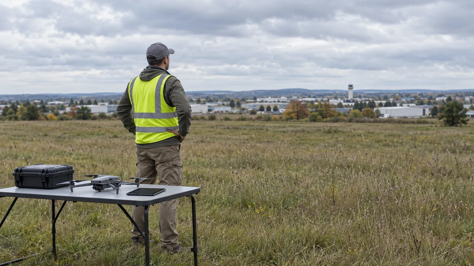
Under Part 107, you need prior air traffic control authorization to fly in Class B, C, or D airspace, or within the lateral boundaries of a Class E surface area designated for an airport. Flying below 400 feet does not create an exception. The deciding facts are the airspace at your flight's location, altitude, and time, including the specific Class E designation. The controlling rule is 14 CFR § 107.41.
For routine flights needing approval, use an FAA-approved LAANC service or FAA DroneZone. A pilot certificate qualifies the pilot; an airspace authorization permits a defined operation in the specified airspace. Neither replaces the other.
On This Page
- Decide from the airspace you will actually enter
- Resolve the Class E and airport-hours exceptions
- Separate altitude limits from permission
- Choose the official FAA application route
- Keep the authorization and supporting records
- Make the final flight decision
Decide from the airspace you will actually enter
For a U.S. civil small-drone operation conducted under Part 107, assess the entire flight area and altitude range. A launch point outside controlled airspace does not cover a route that crosses into it. Likewise, an airport's distance from the launch point does not by itself answer whether authorization is required. These are Part 107 rules; an operation conducted under a different legal authority needs the requirements attached to that authority.
Use the following decision table after identifying the current airspace. A “no” in the authorization column answers only the § 107.41 question; it does not establish that the flight is otherwise permissible.
| Planned operating situation | Prior authorization under § 107.41? | What changes the decision |
|---|---|---|
| Inside Class B, C, or D airspace | Yes | Even a low flight within a surface area needs approval. |
| Within a Class E surface area designated for an airport, identified as E2 | Yes | An airport does not need an operating tower for this requirement to apply. |
| In a Class E surface extension outside the airport's E2 surface area | No, solely because of that extension | Confirm the designation and check for overlapping airspace that does require approval. |
| In Class G below an elevated Class B or C shelf | No, while remaining in Class G | Entering the overlying shelf changes the answer. |
| In Class G beneath Class E that begins at 700 or 1,200 feet above ground | No, while remaining in Class G | A Class E transition area is different from an airport surface area. |
| Near an airport in Class G | No, solely because an airport is nearby | Airport traffic and other flight restrictions still matter. |
Source basis: Part 107, §§ 107.41 and 107.43, the FAA Aeronautical Information Manual's airspace descriptions, and FAA Order JO 7210.3, section 19-6. The table applies those sources to common planning situations; it is not a map of an actual site.
Imagine two roof inspections at 80 feet above ground. One lies inside an active Class D surface area and needs authorization. The other remains in Class G beneath an elevated shelf and does not need § 107.41 approval. The identical height and work type do not produce the same airspace answer. These are hypothetical examples, not approved flight locations.
Resolve the Class E and airport-hours exceptions
“Class E is controlled airspace” is true but incomplete for this decision. The FAA's processing order specifies that the Class E authorization requirement concerns the airport-designated surface area, E2. Other Class E designations do not automatically carry that requirement. This is why a broad instruction to obtain approval for every Class E area can mislead a remote pilot. See section 19-6-3's Class E note.
The distinction is between the airport surface area, a surface extension, and airspace beginning above the surface. Do not decide from an app's color alone. Check its airspace details against current aeronautical information, particularly when the location is near a boundary or the display does not explain the Class E designation. Charted airspace floors may use mean sea level (MSL), while your requested drone altitude uses above ground level (AGL); account for terrain elevation before comparing them.
Airport operating hours can change the answer. When some part-time Class C or D surface areas stop operating, they become a Class E surface area; others become Class G. A closed tower therefore does not establish that authorization is unnecessary. Consult the airport's current Chart Supplement entry and applicable notices for the planned flight time. The AIM explains the “other times Class E” and “other times Class G” distinction.
If the airspace changes during the intended operating window, evaluate both periods. Keep the flight within conditions you can establish and, where required, obtain approval covering the applicable operation before launch.
Separate altitude limits from permission
The ordinary Part 107 altitude limit and a UAS Facility Map grid value answer different questions. Section 107.51 generally limits flight to 400 feet above ground level, with a specified allowance near a structure. A facility-map value identifies an altitude the FAA may authorize without additional safety analysis. The FAA expressly states that the facility map itself grants no permission to fly.
A grid marked 100 feet is therefore useful when requesting approval. It does not authorize a 100-foot flight. A grid marked zero does not establish that no flight could ever be approved: the FAA allows Part 107 pilots to submit further-coordination requests above grid values, including zero-foot grids, within the program's altitude limits. Approval remains a separate decision. See the FAA's airspace authorization instructions.
The structure allowance also does not waive the airspace rule. Section 107.51(b) permits the specified higher-altitude operation when the aircraft stays within a 400-foot radius of a structure and no more than 400 feet above its uppermost limit. That allowance does not enlarge an airspace authorization or make LAANC an approval path above its 400-foot ceiling. Check both the regulatory altitude condition and the LAANC operating limits.
For example, if your issued authorization permits 100 feet above ground and the inspection needs 140 feet, the operation exceeds that authorization even though both heights are below 400 feet. Revise the job or obtain appropriate approval before conducting the higher flight.
Choose the official FAA application route
LAANC means Low Altitude Authorization and Notification Capability. It connects requests made through FAA-approved service suppliers to FAA airspace data. At supported locations, eligible requests can receive approval in near real time. Select the actual flight area, maximum altitude, date, and time, then read the returned authorization. Use the FAA's current LAANC page and supplier list to check availability and capabilities.
For requests above facility-map values at LAANC locations, use a supplier supporting further coordination when the operation fits that process. FAA guidance requires submission at least 72 hours before the requested start. This is an application lead time, not a promise of approval within 72 hours.
Use FAA DroneZone for airspace authorization at airports without LAANC, and for requests needing its manual process. The FAA asks for requests at least 60 days ahead and warns that shorter notice can result in cancellation or denial. Its instructions cover the responsible party, operation area, altitude above ground, dates, times, time zone, and frequency. Follow the current Part 107 airspace authorization application instructions; a submitted request or reference number is not an issued authorization.
Calling the tower is not a substitute. FAA instructions tell an ATC facility receiving a direct Part 107 authorization request to refer the operator to LAANC or DroneZone. Once an authorization exists, follow any contact requirements it contains. The FAA processing order and LAANC guidance distinguish applying for approval from required operational notification.
An authorization and an operational waiver do different jobs
An airspace authorization addresses access to the specified airspace. An operational waiver permits a specifically approved deviation from a waivable operating rule. Needing both requires addressing both; ordinary airspace approval does not authorize beyond-visual-line-of-sight flight or other deviations.
The FAA currently directs new Part 107 operational-waiver applications to the Aviation Safety Hub, while stating that airspace authorization applications remain in DroneZone. Older instructions may describe a different portal arrangement. Start from the current FAA waiver page when a separate deviation is necessary.
Night flight is another separate condition. Section 107.29 allows compliant night operations without a night waiver when its knowledge-test or training condition and anti-collision lighting requirements are met. The lighting must be visible for at least three statute miles with a flash rate sufficient to avoid collision. Night does not remove § 107.41 authorization requirements. Check the applicable Part 107 night and airspace rules together.
Keep the authorization and supporting records
Read every provision of the issued authorization before relying on it. For field use, retain an accessible copy with its identifier, approved area, altitude, dates and times, and any notification or termination requirements. An offline copy is a practical way to avoid depending on a working mobile connection at the site.
Separate required documentation from a useful operating record:
- Regulatory records: Section 107.7 requires the remote pilot certificate and identification to be in physical possession and readily accessible when exercising certificate privileges. Required documents, records, or reports must be made available to the FAA on request. Retain documents required by the authorization or any waiver as well.
- Recommended mission record: Keep the request, issued decision, airspace information used, preflight review, and any changes to the planned operation. This helps a team show why it flew within the approved limits; it is not a claim that Part 107 mandates one universal flight-log format.
- Team authorization records: For DroneZone authorizations, follow the responsible party's documentation duties for participating pilots and aircraft identified by the FAA's application instructions.
These distinctions follow § 107.7 and the preflight duties in § 107.49, together with the DroneZone responsible-party instructions. The offline-copy and mission-record suggestions are practical recordkeeping recommendations.
Make the final flight decision
Before launch, match the actual operation to the authorization and recheck current airspace restrictions. Part 107 still requires a preflight assessment, yielding to other aircraft, and avoiding interference with airport traffic. Temporary flight restrictions and prohibited or restricted areas remain separate constraints. Permission from a property owner does not resolve them, and an airspace authorization does not grant access to a launch site. The relevant flight duties appear in §§ 107.37 and 107.43–107.49.
The limited emergency deviation in § 107.21 applies to an in-flight emergency requiring immediate action, only to the extent necessary. It is not advance permission to launch an unauthorized job; an FAA-requested written report may follow a deviation.
Make the decision in this order: establish the airspace for the whole flight, obtain any required approval, and confirm that the operation meets its conditions and the remaining rules. If the class or operating hours remain uncertain, resolve them before committing to the flight. Recheck FAA portal instructions, LAANC coverage, map values, and current restrictions when planning each operation because these details can change.
Sources
- 14 CFR Part 107: Federal regulatory text covering airspace authorization, altitude, night operations, emergency deviations, preflight duties, and document availability.
- FAA Aeronautical Information Manual, section 3-2: Official guidance on airspace dimensions, Class E types, and part-time surface areas.
- FAA Order JO 7210.3, section 19-6: ATC processing instructions clarifying E2 airspace and why direct tower contact does not replace an authorization request.
- FAA UAS Facility Maps: Explanation of grid values and the explicit distinction between a map and permission.
- FAA UAS Data Exchange: LAANC: Program scope, service suppliers, altitude limits, and notification guidance.
- FAA Part 107 Airspace Authorizations: Application routes, lead times, further coordination, and responsible-party documentation.
- FAA Part 107 Waivers: The purpose of operational waivers and current application-portal routing.
The eCFR displayed Title 14 as current through September 3, 2026. Verify current airspace information and authorization conditions for each flight.
Last checked: September 7, 2026.