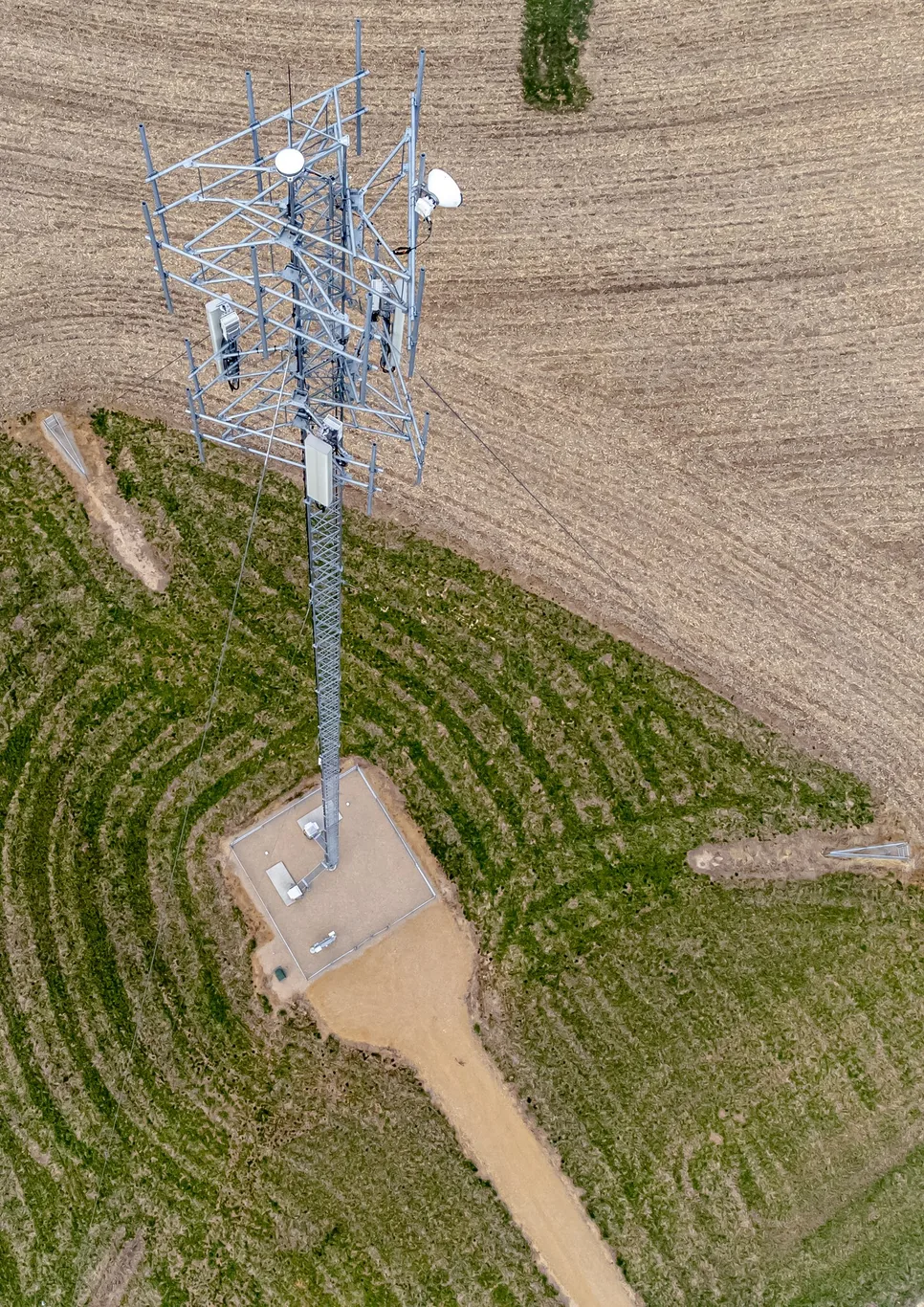

The Part 107 altitude limit is normally 400 feet above ground level. You may fly higher without an altitude waiver when the drone stays within a 400-foot radius of a structure and no more than 400 feet above that structure's uppermost point. Both conditions must hold. An airspace authorization can impose a lower ceiling, and the structure exception does not raise it. 14 CFR § 107.51 supplies the altitude rule.
Before planning a climb, determine the height above the ground beneath the aircraft, whether the structure exception actually covers the route, and what the airspace permits. The highest number your controller will accept is not an FAA approval.
On This Page
- Which flights use this rule?
- Measure altitude from the ground beneath the drone
- Apply both parts of the structure exception
- Keep airspace permission separate
- When an altitude waiver is needed
- What to document before flight
- Choose a ceiling the whole flight can meet
Which flights use this rule?
This explanation covers U.S. civil small-drone operations under Part 107, involving aircraft weighing less than 55 pounds at takeoff, including everything attached or carried. It is especially relevant to inspection, photography, and mapping work. Payment alone does not determine the operating rules: an unpaid flight supporting a business or organization can still be non-recreational. The FAA's recreational-flyer guidance explains that distinction.
Do not borrow Part 107's structure allowance while flying under the separate recreational exception in 49 U.S.C. § 44809. The ordinary recreational Class G ceiling is 400 feet. Specific FAA-authorized recreational sites have their own arrangements; proximity to a tower alone supplies no additional permission. A pilot may instead conduct a recreational-purpose flight under Part 107 by meeting its requirements, as the FAA Aeronautical Information Manual explains.
An altitude allowance also leaves the rest of the operating rules in place. A route around a tall building must still satisfy Part 107 visual line of sight rules. If it crosses occupied sidewalks or work areas, assess the separate conditions for flying over people under Part 107. Those obligations appear in §§ 107.31 and 107.39 of Part 107.
Measure altitude from the ground beneath the drone
Above ground level (AGL) describes height above the terrain at the aircraft's location. Mean sea level (MSL) uses a common elevation reference. A height relative to takeoff is a third measurement. They coincide only under particular conditions.
Consider a hypothetical flight that launches at an elevation of 1,000 feet MSL and climbs 300 feet. The aircraft is then at 1,300 feet MSL. If it flies level over ground at 800 feet MSL, its height becomes 500 feet AGL, even though it remains 300 feet above the launch elevation.
Height AGL = aircraft altitude MSL − ground elevation MSL.
For this example: 1,300 − 800 = 500 feet AGL.
These are illustrative inputs, not measurements from a flight. Without a qualifying structure or waiver, that segment exceeds the ordinary limit. The calculation applies the ground reference in § 107.51(b).
Check what your aircraft's height display actually references before using it to manage terrain clearance. Review the outbound route, turns, and return path against terrain elevations, then leave room for uncertainty. A single launch-relative height setting cannot establish compliance over changing ground. This is a planning recommendation derived from the AGL limit, not a claim about any particular controller. For learners who need to connect altitude references with charts and weather, the Part 107 study guide puts those subjects in a useful learning sequence.
Apply both parts of the structure exception
Under § 107.51(b), the drone must remain within the structure's 400-foot radius and at or below 400 feet above its immediate uppermost limit. Treat the radius as the boundary of the qualifying area, not as extra distance available from wherever the pilot stands.
For a hypothetical tower whose top is 600 feet above level surrounding ground, the altitude provision allows up to 1,000 feet AGL while the drone remains within that radius: 600 + 400 = 1,000 feet. This arithmetic addresses altitude only. It does not establish that visibility, airspace, weather, or the aircraft make that height usable.
Worked structure scenarios
Assume level ground, a tower top at 600 feet AGL, no altitude waiver, and no lower airspace limit. Distances are measured from the tower.
| Proposed position | Altitude-rule result | What changes the result? |
|---|---|---|
| 200 feet from the tower, 900 feet AGL | Within the structure allowance | Both radius and upper-height conditions are met. |
| 450 feet from the tower, 900 feet AGL | Outside the allowance | The drone has left the 400-foot radius. |
| 200 feet from the tower, 1,050 feet AGL | Outside the allowance | The flight exceeds the tower-top-plus-400-foot ceiling. |
| 450 feet from the tower, 350 feet AGL | Within the ordinary altitude limit | No structure exception is needed at that height. |
Source basis: editorial scenarios applying § 107.51(b), checked September 8, 2026. These results are not approvals for a particular site.
Plan the transition away from the structure before takeoff. If the return route leaves the qualifying area, get back within the ordinary ceiling before crossing that boundary. Launching from a roof does not make the roof the ground reference for the rest of the route.
Other constraints may require a much lower flight. Section 107.51 also requires at least three statute miles of flight visibility from the control station and separation of at least 500 feet below clouds and 2,000 feet horizontally. A tall structure creates no exception to those weather limits.
Keep airspace permission separate
Section 107.41 requires prior air traffic control authorization in Class B, C, or D airspace, and within the lateral boundaries of the airport-designated Class E surface area. Not every Class E area is that surface area. Check the actual airspace covering the proposed flight, including its vertical limits.
If your authorization permits 100 feet AGL, proximity to a taller building does not raise that ceiling. Request permission covering the needed height and operation. Conversely, an airspace approval does not automatically waive the altitude rule. Read the regulations and deviations actually covered by the issued document.
The FAA's LAANC guidance describes automated airspace authorization using UAS Facility Map values. A map grid value alone is not permission to fly. Part 107 pilots can request further coordination above a grid's value, up to 400 feet AGL; a further-coordination request is not an approval while it is pending. For more detail on How to Use LAANC for Controlled Airspace Authorization, see our How to Use LAANC for Controlled Airspace Authorization.
For manual requests, follow the FAA Part 107 Airspace Authorizations page. DroneZone handles requests at airports without LAANC and can also handle requests at LAANC-enabled facilities. An operation above 400 feet needing ATC permission requires coordination beyond LAANC's ordinary ceiling. Describe the exact height, location, structure allowance or altitude waiver, and obtain an issued authorization covering the operation before flying.
When an altitude waiver is needed
A planned flight beyond § 107.51(b)'s ordinary limit and structure allowance needs an FAA waiver of that provision. Part 107, Subpart E allows the FAA to authorize specified deviations when the proposed operation can be conducted safely under the certificate's conditions. There is no universal replacement altitude: use the ceiling and boundaries in the actual waiver.
For a new application, use the Aviation Safety Hub linked from the current FAA Part 107 Waivers page. The FAA says previously submitted waivers continue in DroneZone; airspace-authorization applications also remain there until further notice. Avoid relying on an older tutorial's portal instructions.
- Identify every provision the operation cannot meet, including § 107.51(b) and any separate visual-observation limitation.
- Describe the flight area, requested maximum AGL altitude, aircraft, personnel, and how risks will be controlled.
- Address the applicable FAA safety-explanation questions and submit the application through the current service.
- Respond to information requests and wait for the issued decision before conducting the deviation.
The FAA's review goal is 90 days, with timing dependent on complexity and application completeness. It is not an approval guarantee. Its current instructions say an unanswered information request leads to cancellation after 30 days.
Explain how the higher flight will stay safe
The altitude section on page 12 of the FAA Waiver Safety Explanation Guidelines asks how the operation will protect other aircraft, people, and property. It also asks how the crew will see and avoid traffic, and how the pilot will determine location, AGL altitude, and direction while maintaining the required visual observation.
It asks about lighting that makes the drone visible to other aircraft, the flight area's relationship to the nearest airport, and applicable notices to airmen (NOTAMs) and ATC coordination. Answer with the actual procedures, equipment, and supporting evidence for the requested operation. These are application guidance questions; the issued waiver's special provisions establish the conditions for the approved flight.
An in-flight emergency is a separate exception
Section 107.21 permits the remote pilot in command to depart from a Part 107 rule only as necessary to address an in-flight emergency requiring immediate action. The FAA may request a written report of the deviation. This cannot serve as advance permission for a planned over-limit climb or routine return maneuver.
What to document before flight
Section 107.51 does not prescribe a special altitude-exception form. Section 107.49 does require a preflight assessment that includes weather, airspace, restrictions, and ground hazards, plus briefing the participants. Section 107.7 requires the pilot's certificate and identification to be physically possessed and readily accessible when exercising certificate privileges, and required records to be made available to the FAA on request. These duties are in Part 107.
For an ordinary structure flight, a useful planning record includes:
- the structure's location, top elevation, and the source of that information;
- ground elevations along the route and the height reference used by the aircraft;
- the qualifying radius, working ceiling, and planned descent before leaving it;
- applicable airspace permission, limits, dates, and operating area;
- weather and visibility checks, crew positions, and contingency actions.
This is a recommended record, not a federally prescribed form. Retain the actual waiver or authorization when one applies and follow its specific documentation and coordination conditions. A copy of another operator's approval supplies no authority for your flight.
Choose a ceiling the whole flight can meet
Set the operating height from the complete route: ground reference, structure boundary, airspace authorization, visibility, and weather. Include automated return behavior in that plan. If any segment needs permission you do not yet have, lower or redesign the flight, or obtain the applicable approval before committing to the job.
Sources
- 14 CFR § 107.51. Federal altitude, structure, visibility, and cloud-clearance rules; basis for the worked examples.
- 14 CFR Part 107. Federal applicability, visual-observation, people, airspace, inspection, and preflight requirements.
- FAA: Recreational Flyers and Community-Based Organizations. Guidance distinguishing recreational and non-recreational operations and their ordinary limits.
- FAA Aeronautical Information Manual, section 11-4. Airspace-access guidance, including Part 107 flights for recreation and authorized recreational sites.
- FAA: UAS Data Exchange, LAANC. Automated authorization, facility-map values, and further coordination.
- FAA: Part 107 Airspace Authorizations. Manual and LAANC application routes.
- 14 CFR Part 107, Subpart E. Waiver authority and compliance with the issued certificate's conditions.
- FAA: Part 107 Waivers. Current application portal, transition instructions, and response timelines.
- FAA Waiver Safety Explanation Guidelines, page 12. Altitude-specific application questions, revised June 14, 2024.
- 14 CFR § 107.21. In-flight emergency deviations and reports requested by the FAA.
Last checked: September 8, 2026. Recheck the current regulation, FAA application service and guidance, flight restrictions, and your issued approval's conditions before relying on them for a flight.